Estimation of the Urban Temperature Reduction Effect in Low-rise Residential Areas using CFD Simulation based on the Shape of the Green Space
ⓒ 2023. KIEAE all rights reserved.
Abstract
Rapid urbanization has exacerbated the influence of the urban heat island effect in existing cities, particularly, in low-rise and densely-populated areas. Accordingly, small urban green spaces have been employed to lower the temperatures in urban areas and improve the quality of life. However, the current research on the quantitative analysis of the size and shape of urban green spaces, which maximize the temperature-reducing effect, is insufficient. Therefore, a quantitative analysis was performed in this study to determine the impact of the shape of an urban green space on the cooling effect of vegetation and range of impacts based on three elements: the area, perimeter, and shape index of the urban green space.
A computational fluid dynamics (CFD) simulation was performed and used to analyze the impact of the shape of the urban green space on the temperature-reducing effect and range of impacts by examining eighteen urban green spaces in three target areas. To this end, programs such as STAR-CCM+ and GIS were employed.
The analysis results show a meaningful relationship between the green space area and range of the cooling effect of the vegetation, and indicate the importance of the perimeter of the vegetation in reducing the temperature of the central and surrounding areas of the urban green space. Moreover, although the shape index is not a decisive factor, slender and intricate shapes were found to have a higher cooling effect for a short distance. Therefore, this study contributes to the establishment of a guideline for the development of a pleasant environment in existing cities.
Keywords:
Urban Green Space, Computational Fluid Dynamics (CFD), Low-rise Residential Area, Urban Heat Island, Urban Regeneration키워드:
도시 녹지, 전산유체역학, 저층 주거지, 도시 열섬, 도시 재생1. Introduction
1.1. Research background and purpose
Currently, the rapid urbanization being experienced in cities is causing various problems because the green areas that were secured are insufficient. Among them, the urban heat island effect has received increased attention. This effect refers to a phenomenon wherein the center of a city exhibits higher temperatures than the suburban areas. This is caused by a reduction in the green space owing to changes in the ground cover, an increase in the reflectance due to a higher ground surface pavement and larger total floor area of the buildings, carbon dioxide emissions from human industrial activities, and the generation of artificial heat in cities[1] . This urban heat island phenomenon affects the overall human life including increased energy consumption in cities, diminished quality of life for vulnerable societal classes, an increase in the number of patients with heat-related illness, and intensified air pollution[2]. Particularly, this phenomenon is more significant in old downtown areas where the population density increases over a short period of time without proper planning on the use of the existing urban infrastructure.
Land use in cities is known to affect both urban climate control and the mitigation or intensification of urban heat islands. According to a related study, the heat island phenomenon is significant in densely-populated areas owing to high-density development, and an abundance of green space is effective in mitigating the heat island phenomenon[2]. In addition, insufficient quantities of green spaces in a city results in a lack of rest areas for citizens, a reduction in the habitats used by organisms, and the exacerbation of the residential environment in the city. Generally, urban green spaces affect urban climate control; however, studies on the effect of each element, including the size, shape, and location of urban green spaces, on climate control are insufficient. In this situation, minimum quantitative criteria such as the criterion for the area of the urban green space per capita have been suggested, but specific and qualitative criteria such as the shape, location, size, and facility criteria, have not been presented, making it difficult to perform planning in the field.
As such, the aim of this study is to empirically study the urban temperature reduction effect based on the shape of the urban green space, particularly in low-rise densely-populated residential areas in old downtown areas. This is because the urban green spaces in such areas have different shapes and sizes since they are relatively insufficient and developed later. Therefore, these research results can be utilized as important references when developing additional urban green spaces in old downtown areas.
1.2. Research method and scope
The spatial scope of this study was set to 1034-8 Joyang-dong, Sokcho-si, Gangwon-do; 16 Hapjeong-dong, Pyungtaek-si, Gyeonggi-do; and 11-10 Bisan-dong, Seo-gu, Daegu, South Korea. These areas were chosen owing to the following reasons. First, objective meteorological measurements, which are essential for this study, can be obtained from the automatic weather system (AWS) of the Korea Meteorological Administration (KMA), which is installed nearby. Second, these areas are low-rise densely-populated residential areas that were developed long ago. Third, these areas contain more than five types of urban green spaces that were later naturally or artificially developed within the scope of the simulation (1km2).
The temporal scope of this study, which is the period within which the latest verified meteorological data are available, was June to August of 2021, a midsummer period with the highest average temperature in the cities. The basic urban- and building-type data such as the topography, shape and height of buildings, and road types, were based on the basic spatial information (2015) provided by the National Geographic Information Institute (NGII), which was updated based on the latest aerial image data.
In this study, a theoretical review of the literature related to the influence of urban green spaces on the urban heat island effect was conducted. Subsequently, modeling and meteorological data acquisition were then performed in the target areas, and based on the results, the proposed research model was verified using a computational fluid dynamics (CFD) simulation. A CFD simulation was then conducted, the temperature correlations were analyzed using the area, perimeter, and shape index of each green space based on the temperature data extracted from the CFD simulation results, and the influence range of the temperature reduction effect was analyzed for each green space. Finally, the implications of developing urban green spaces in the future were derived based on the results.
2. Theoretical Review
2.1. Review of the theory
The urban heat island effect is a phenomenon whereby the surface and air temperatures in urban areas are higher compared to those in suburban areas, forming an island-like distribution pattern. For city centers, the average temperature is 0.3 to 10℃ higher than those in adjacent suburban areas[1]. The temperature of urban areas where paved roads are densely located is relatively higher compared to that in suburban areas with fewer paved roads because more solar energy is absorbed during the day and released at night. The urban heat island phenomenon is particularly more significant in the summer, and it causes an increase in the energy consumption and the aggravation of the living environment, resulting in a negative impact on the health of residents[1]. Additionally, the temperature rise in cities needs to be carefully managed because it affects the carbon emissions and may have a negative impact on the carbon neutrality, which has been implemented worldwide.
The causes of urban heat islands include changes in the ground cover (reduced green space, a higher surface pavement, and increased reflectance due to an increase in the total floor area of buildings ), generation of artificial heat in cities, air pollution, and city/building shapes. Among these, the building height, shape of the spacing between buildings, density of high buildings, land cover, building use, distance between buildings, and retreat depth on the first floor have been investigated in several studies[3].
From this perspective, the lack of sufficient green areas in cities intensifies the urban heat island phenomenon. Moreover, a lack of rest areas for citizens and reduced habitats for organisms exacerbate the living environment. However, these issues can be solved using changes in the land cover, greening projects including tree planting, and creation of wind corridors[1].
Urban green spaces are important for urban climate control and urban heat island mitigation because the evapotranspiration of vegetation in such spaces controls urban temperatures. According to related studies, the intensity of urban heat islands decreases as the city green space coverage increases, and the temperature reduction effect inside and outside the green space increases as the size of the green space increases[4]. Moreover, because it is practically difficult to establish large green areas in cities, it is recommended to distribute the green spaces to obtain an optimal temperature reduction effect[4]. Therefore, it is essential to secure a number of small-scale green spaces in a city to effectively manage urban climate and reduce carbon emissions.
CFD is a method of analyzing the dynamic motion of a fluid using a computer. To this end, Navier-Stokes equations, which are the equations of fluid motion, are converted into algebraic equations using the finite volume method (FVM), and a simulation is performed to analyze the fluid motion using a numerical analysis algorithm[5].
CFD makes it possible to conduct numerical analysis on complex and fluid flows, which could not be theoretically analyzed in the past[6]. In the architectural field, CFD was used to identify local indoor airflow, and with the improvement in the computer performance, it is now being used in various ways to predict the temperature distribution, airflow velocity and direction, turbulence distribution, and diffusion of air pollutants (such as particulate matter (PM)) in large spaces (such as external urban spaces).
In CFD, similar tasks can be easily repeated, analyses can be performed within a short period of time through simulations in a virtual space with conditions similar to the actual ones, and simulations can be performed using different settings. The use of CFD also enables numerical and coupled analyses such as those on radiant heat transfer to be performed, making it possible to quantitatively analyze complex conditions[6].
There are many simulation software programs based on CFD, including HEXAGON scSTREAM, Siemens STAR-CCM+, and ANSYS Fluent. In this study, STAR-CCM+, a general-purpose heat and fluid analysis software program developed by Professor A.D. Gosman’s team at the Imperial College in the UK, was used. STAR-CCM+ was commercialized in 1985 and has been widely used worldwide, including in the United States, UK, Germany, Japan, and France[6].
2.2. Review of previous studies
The previous studies on the changes in the microclimate due to green spaces can be mainly classified into three categories. The first involves studies that employed the direct measurement of microclimate changes using AWS, the second involves studies wherein the change in the surface temperature was measured using aerial and satellite images based on methods such as Landsat and light detection and ranging (LiDAR), and the third involves studies wherein research was conducted using a CFD simulation software and based on an assumed green space type and shape. Table 1. summarizes the review of the previous studies based on these three types.

Summary of the literature review
First, J. K. Kim et al. (2020) analyzed the factors that affect the temperature of the Minjumaru Square, a green space in University C, using AWS measurements. This is an important study because the temperature changes were measured in a small area according to the cover, space, and vegetation[7]. G. W. Lee and Y. N. Jeong (2018) developed a microclimate map using KMA AWS by directly measuring the AWS values and analyzing the microclimate situation in declining areas. They revealed that a temperature change of more than 2℃ can occur within a radius of 500 m depending on the space shape and cover condition[8].
However, studies that use AWS measurements are faced with the difficulty of solving the error caused by the accuracy of measurements and particularity of the measurement time, and only measurements in a small area can be obtained. Moreover, they can only measure the current climatic environment.
Piao, Yulin and Y. H. Kim (2021) analyzed the temperature reduction effect and its range of influence based on the area, shape, and perimeter of urban green spaces in Cheonju using Landsat8 satellite images and the ArcGIS software. They classified the temperature reduction effect according to the area, shape, and perimeter of the green spaces, and identified the most efficient green area through regression analysis considering the temperature reduction effect[9]. K. J. Kim et al. (2018) analyzed the temperature reduction effect in Seoul according to the green space type and subsequent building energy reduction effect using Landsat8 satellite images, making it an important reference for this study[10]. Typically, the use of satellite or aerial images for analysis enables the analysis of larger spaces compared to using AWS. However, it is difficult to simulate the atmospheric temperature even though it is possible to measure the land surface temperature.
For studies that used CFD, W. K. Bae and J. H. Kang (2022) analyzed the temperature change according to the arrangement of the pilotis and green spaces in an apartment complex in Seocho-gu using the ENVI-met software. This is an important study is because the influence of rooftop green spaces, wall green spaces, and pilotis on the microclimate was examined by applying various design scenarios[11]. J. H. Kim et al. (2012) analyzed the changes in the thermal environment of an apartment complex in Suwon before and after the construction of new buildings according to the change in the green area ratio using Star-CCM+, making it an important study for reference significant[6]. S. H. Hong et al. (2020) analyzed the effects of the building height and roadside green spaces on the PM concentration using an ENVI-met simulation[12]. S. H. Kim and W. K. Bae (2021) conducted research on the fine dust reduction effect based on a green space in the alley of a low-rise residential area using ENVI-met. They examined the effect of the green space arrangement on the improvement of the low-rise residential area environment[5]. G. W. Lee (2021) analyzed the effect of developing small-scale green spaces on the microclimate of an urban regeneration area in Daegu using Star-CCM+[3].
There are also a number of overseas studies that have analyzed the temperature reduction effect of green spaces using CFD simulations. Among them, Yupeng Wang (2015) compared the temperatures estimated using ENVI-met with the actual temperature of the downtown and airport areas of Toronto, Canada, from January 16th to 17th and from July 17th to 18th, 2013. They verified the temperature reduction effect of the cool pavement, cool roof, green areas, and UHI for the detached house, middle-rise, and high-rise areas in the city[13]. Wanlin Liu et al. (2022) estimated the microclimate of an area that had water bodies and green spaces in Dujiangyan, Chengdu, the capital of Sichuan Province in China. They employed CFD simulations using Fluent to acquire meteorological data, maps, and remote sensing images in January and August 2018, and calculated the greenhouse gas emissions from residential areas by inputting the estimation results into HDY-SMAD, which estimates the building energy consumption. They found that the appropriate area ratio between the distributed green spaces and water bodies is 3:1, and that 1:2 is appropriate for the summer[14].
In all previous CFD-related studies, the expected effect was estimated using scenarios based on conditions expected in the future. Therefore, CFD is more beneficial than the previous two research categories because the expected effect can be measured in advance under specific assumptions.
2.3. Research issue and setting the hypothesis
As aforementioned, there are several studies on temperature reduction using green spaces; however, very few have employed the conversion of the area and shape of each green space into quantitative indices and analyzed the temperature reduction effect accordingly. Based on these studies, the following research issues and hypotheses were derived:
1. The size of the green space affects the temperature reduction effect.
2. The temperature reduction effect of the green space is different depending on the shape of the green space.
3. The influence range of the temperature reduction is different depending on the size, perimeter, and shape of the green space.
3. Analysis System
3.1. Selection of the target areas
To verify the abovementioned research hypotheses, three target areas were selected based on the following criteria. First, the area must support easy objective data acquisition due to the short distance from the KMA AWS. Second, the area must comprise old low-rise densely-populated residential areas. Third, various types of natural or artificial green spaces must be present within the simulation target range of 1km2. Based on these criteria, the following areas were selected: 1034-8 Joyang-dong, Sokcho-si, Gangwon-do; 16 Hapjeong-dong, Pyungtaek-si, Gyeonggi-do; and 11-10 Bisan-dong, Seo-gu, Daegu, South Korea.
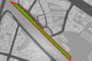
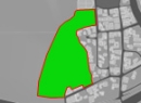
The first target area, 1034-8 Joyang-dong, Sokcho-si, Gangwon-do, is close to the East Sea and Lake Cheongcho (Fig. 1.). This area is dominated by type-2 general residential areas mixed with some general commercial areas located around the Donghae-ro six-lane road. This area represents the residential areas created long ago around the port.

Site 1: Sokcho (Source: https://map.naver.com/(2022.12))
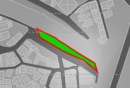
The second target area, 16 Hapjeong-dong, Pyungtaek-si, Gyeonggi-do, is close to Pyungtaek City Hall and dominated by type-2 general residential areas (Fig. 2.). It comprises a low-rise densely-populated residential area that retains the old urban structure even though several large facilities such as Sosabeol Leports Town have been constructed.

Site 2: Pyungtaek (Source: https://map.naver.com/(2022.12))
The third target area is 11-10 Bisan-dong, Seo-gu, Daegu, which includes the ‘Indongchon urban regeneration’ area. This is an area that was developed based on the third industrial, dyeing industrial, and Seodaegu industrial complexes during the boom period of the textile industry in Daegu (Fig. 3.). It was a residential area around industrial complexes where a large population once lived; however, population outflow has been recently accelerated by changes in the industrial structure[3].

Site 3: Daegu (Source: https://map.naver.com/(2022.12))
3.2. Setting the target green space
These areas highlight the declining trend in the characteristics of residential areas in Korea, where grid systems and unorganized irregular urban space types are mixed. Moreover, since the green spaces were created using the existing urban structure, various types of special green spaces such as linear green spaces are present. Therefore, the effect of developing parks and green spaces and controlling various variables in the target areas to determine the implications of including green spaces in domestic urban regeneration projects or urban restructuring processes was verified in this study.
3.3. Shape index of the green space
The shape index was derived by applying the abovementioned shape index calculation formula to the green blocks employed in this study to quantitatively analyze their spatial characteristics. This index was introduced by J. H. Suh et al (1999) for landscape analysis[15, 16], and was applied by Piao Yulin and Y. H. Kim (2021) to analyze the temperature distribution based on the shape of the green space using Landsat8 satellite images of Cheongju[9]. This index is defined using Eq. 1.
Modeling results for each green areas
| (Eq. 1) |
D: shape index
S: green block perimeter
A: green block area
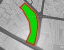
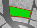
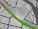
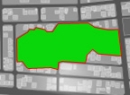
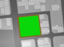
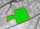
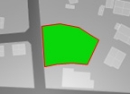
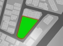
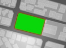
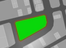
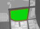
The shape index, which indicates the shape ratio, is 1 for a circular target shape and approximately 1.13 for a square one. As it increases, the shape is longer similar to a rod or closer to irregular shapes such as the star and starfish shapes. Therefore, the shape index can be used to comprehensively express the morphological characteristics of components[9]. Additionally, the area and perimeter were extracted based on Rhino modeling. Table 3. shows the extracted area, perimeter, and shape index calculated using these values.
Index for each shape of the green area
3.4. Analysis method
A 2015 digital map showing the basic spatial information (SHP file provided by NGII) was used to obtain the basic data related to the city/building shapes such as the shapes of roads and buildings, heights of target areas, and distance between buildings. For the green space land cover information, urban planning (spatial facility) map data for 2021 was obtained using V-world (the unique name of the spatial information open platform map), which is operated by the Spatial Information Industry Promotion Agency. The scenarios that changed after 2015 were updated based on the 2021 field work and latest satellite images. For the meteorological data, detailed observation data, including the average wind speed, dominant wind direction, and average temperature, that were measured by KMA through the regional AWS from July 1 to August 31 in 2021, were averaged and utilized.
A modeling area of 1 x 1 x 0.05 km was used. For the domain, the width and length were increased by five times and the height by ten times based on research criteria determined by Hu and Wang (2005)[17]. In addition, a trimmed mesh, one of the basic grid models, and turbulence were generated when developing the model to express the fluid flow. CFD simulators use various techniques to apply the grid, which is the basic unit of flow analysis, to the shape of the model being simulated. Among them, trimmed mesh applies the grid to fit the shape of the model by reducing its size based on a rectangular grid. For areas that require a more specific simulation and observation, the grid was generated by applying three prism layers to obtain more specific research results. The detailed modeling process is summarized Fig. 4. Consequently, approximately 11.8 million grid cells were generated for the target area in Sokcho, 6.1 million grid cells for the target area in Pyungtaek, and 31.4 million grid cells for the target area in Daegu.

Modeling process
The temperature reduction effect of the green spaces was measured using a CFD simulation model. For the model, Navier-Stokes equations were applied as governing equations, and a realizable K-epsilon turbulence model, which is a representative turbulence model, was applied.
Table 4. shows the boundary conditions entered into the simulation for this analysis. Meteorological conditions were assumed for each target area based on the average wind speed, average wind direction, and average temperature measured from July 1 to August 31 in 2021, as shown in Table 4.
Boundary Conditions
The thermal radiation characteristics of the surfaces, which were defined using the land cover conditions, are shown in Table 5.[18]. Moreover, the thermal radiation characteristics were expressed using the density (ρ), specific heat (Cp), thermal conductivity (k), and emissivity (ε), and the thickness of the ground surface was set to a sufficient depth (4 m), which is not affected by the temperature change of the outer surface. For the green space, the latent heat of vaporization was considered.
Properties of the surface material
4. Analysis Results
4.1. Simulation results for each target area
A model that was previously-verified by G. W. Lee (2021) was used to simulate the temperature reduction effect of each green space and its influence range[3]. Fig. 5. shows the simulation results of this model based on the meteorological data for each target area. For an easy comparison, a temperature range of 25.5 to 40℃ was applied.

Simulation results for Sokcho

Simulation results for Pyungtaek
The results show that Sokcho is mainly dominated by southeasterly winds, and the spread of cold air occurs around the main green spaces and lakes.
In Pyungtaek, easterly winds are dominant, and the temperature of the hot air coming from the east decreases after coming into contact with the green spaces between the urban structures inside the target area. However, in the densely-populated central and western areas, the wind speed inevitably decreases and the temperature increases owing to artificial heat.
Finally, the highest overall temperature is observed in Daegu, where a low wind speed and high temperature are also observed owing to the high density of residential areas in the target areas. Moreover, southwesterly winds are dominant, and the wind flows along the linear green space near the Gyeongbu Line railroad to provide the temperature-reduction effect. However, a high temperature is observed in this region because of the difficulty in introducing wind into the internal structure owing to the high residential density.

Simulation results for Daegu
4.3. Green blocks temperature reduction results
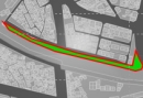
Based on the method described above and models developed according to the types of the selected green spaces, simulations were performed and the temperature change measurements were analyzed. For the temperature of the green space, a buffer was included in the perimeter of each green block and the average temperature in each buffer range was calculated. Because the temperature measurements are not accurate if buildings are present in the buffer range, the temperatures of the areas with buildings were excluded. Fig. 8. shows a graphical representation of the temperatures of each green space based on the buffer distance.

Temperature reduction effect range for the green area block
The temperature reduction effect of the green spaces was first analyzed using graphs. In all graphs, the temperature was lowest at the center of the green space and increased as the distance from the periphery of the green space increased, indicating a reduction in the temperature reduction effect, The reduction effect was shown to range from a minimum of 1–2°C to a maximum of 4–5°C. It was also observed that the temperature reduction effect has an influence at a distance of 10–300 m from the periphery of the green space.
Additionally, the results for G10 and G18 show that the absolute temperature of the green space decreases as the green space area increases, and that the temperature reduction effect in the surrounding areas is larger as the green space area increases.
The results for G3 to G7 show that the absolute temperature tends to decrease as the slenderness of the shape of the green space increases. However, for the cases where the absolute green space area is large, the absolute temperature is not exceeded.
When the green spaces excluding G3 to G7, G10, and G18 were compared, it was observed that the temperature reduction effect in the surrounding areas decreases as the slenderness of the shape of the green space increases. This effect is larger when the shape of the green space is close to a square shape.
Table 6. shows the analysis of the correlations between the temperatures for each buffer distance and variables for each spatial feature.
Correlation coefficients and R2 between the shape index and temperature
The area and perimeter show negative correlations, indicating that the temperature decreases as the area and perimeter increase. Moreover, the shape index exhibits negative correlations, confirming that the temperature decreases as the shape index increases, that is, as the shape becomes more complex.
For the R2 of each spatial feature, the R2 value for the area tends to increase up to a distance of 100 m before decreasing. This means that significant levels are influenced by the green space area for a distance of up to 100 m.
For the perimeter of the green space, the explanatory power was highest at the center and decreased until a distance of 25 m before increasing until 300 m. This means that the temperature of the green space and its vicinity can be determined based on its perimeter, and that the explanatory power decreases as the distance increases.
In the case of the shape index, R2 is relatively small compared to the area or perimeter of the green space. However, the phenomenon wherein the temperature at the center decreases as the shape of the green space becomes simpler can be explained.
When these three indices were analyzed, it was found that the green space area is an index that can be used to determine the influence range of the temperature reduction effect of the green space. Particularly, the perimeter of the green space is considered an important variable used to determine the temperature reduction effect of the green space at the center and its vicinity. Moreover, when the slenderness or complexity of the shape increases, the temperature reduction effect is observed; however, its length of influence is short and is only effective in the vicinity. This is regarded to be due to the reduction in the effective area by half in the calculation formula of the shape index, which influences the temperature reduction effect caused by the green space area over a long distance.
Therefore, the green space area is an important factor when analyzing the temperature reduction effect of the green space over a longer distance. Additionally, it is more effective use a slender or irregular green space over a square one when maximizing the perimeter of the green space to maximize the temperature reduction effect over a short distance. This result confirms the findings of G. W. Lee (2021) that the temperature reduction effect of linear green spaces is larger over a short distance[3].
5. Conclusion
In this study, the effects of three variables of green space, that is, the area, perimeter, and shape index, on the temperature reduction effect of the green space were examined. Particularly, the climate control effect of urban green spaces on the urban structure was quantitatively investigated by examining the temperature reduction effect of green spaces based on the distances from the center and periphery of the green space. In other words, the influence range of temperature reduction was derived based on the radius of the green space, and it was confirmed that the area, perimeter, and shape of the green space are correlated with urban temperature changes.
The green space area was found to be the most important variable when controlling the temperature of a wide area using green space. When a sufficient green space area is not available, the perimeter of the green space can be increased to maximize the temperature control effect at the center of the green space and areas adjacent to it. Moreover, although the shape of the green space is not an important factor for temperature control, slender or complex green spaces were found to be more favorable than square-shaped ones to maximize temperature control in adjacent areas.
The following limitations were encountered in this study. First, the samples for regression analysis were insufficient. Since 18 cases were investigated in this study, it is difficult to generalize them as perfect statistical results. Moreover, detailed green space characteristics such as the details of the arrangement of trees and green spaces were not reflected in the modeling, and because the temperature reduction effect of green spaces also varies depending on the tree characteristics, it is necessary to supplement the results in the future by employing them in the modeling and simulations based on the methods in related studies. Finally, the location of the green space in a city is also an important variable. In particular, locations in wind corridors and those surrounded by low-rise high-density buildings may have a significant influence on the temperature reduction effect and influence range. The fact that such complex locational characteristics could not be considered in this study is also a limitation. In addition, most foreign researchers employed both simulations and measurements in their studies; however, the change in the actual temperature distribution based on the distance from the center of the green space was not considered in this study even though actual temperature data were utilized.
Nevertheless, the results of this study are more important than those in previous studies because the basic morphological characteristics required to maximize the urban temperature reduction effect when developing green spaces in existing downtown areas were quantified and analyzed using computational fluid dynamics (CFD). Particularly, the temperature reduction effect of each urban green space was quantitatively analyzed based on its area, perimeter, and shape, and their effects on temperature control was verified based on the distance. Although CFD has been used for urban design in several studies, the shape of the green spaces in this study was quantified by introducing the shape index, and attention was paid to the temperature reduction effect based on the shape of the green space and distance to actual green spaces with different shapes and sizes. Therefore, these results can be used as a reference in the derivation of important design guidelines for the development of urban green spaces in existing cities.
Acknowledgments
This work is supported by the Korea Agency for Infrastructure Technology Advancement (KAIA) grant funded by the Ministry of Land, Infrastructure and Transport (Grant 22UMRG-C158194-03).
References
-
김수봉, 김기호, 조진희, 도시열섬현상의원인과 대책, 한국. 환경과학논집 제6권 제1호, 2001.12, pp.63-89.
S.B. Kim, G.H. Kim, J.H. Cho, The urban heat island phenomenon and potential mitigation strategies, Korea: Journal of Nakdong River Environmental Research Institute, 6(1), 2001.12, pp.63-89. -
제민희, 정승현, 토지이용 유형별 도시열섬강도분석, 한국: 한국콘텐츠학회논문지, 제18권 11호, 2018.11, pp.1-12.
M.H. Je, S.H Jung, Urban heat island intensity analysis by landuse types, Korea: Journal of the Korea Contents Association, 18(11), pp.1-12 -
이건원, 도시재생사업의 소규모 녹지 조성이 바람길형성 및 열환경에 미치는 영향: 대구 인동촌백년마을도시재생활성화 지역을 중심으로, 한국: KIEAE Journal, 제21권 제5호, 2021.10, pp.91-100.
G.W. Lee, The impacts of creation of small green areas within urban regeneration projects on the formation of wind paths and the thermal environment: Focused on Indongchon, one of the urban regeneration and revitalization areas in Daegu, Korea: KIEAE Journal, 21(5), 2021.10, pp.91-100. [ https://doi.org/10.12813/kieae.2021.21.5.091 ]
-
윤용한. 녹지에 의한 열섬현상의 저감효과에 관한 연구, 한국: 국토계획, 제36권 제2호, 2001.04, pp.187-196.
Y.H. Yoon. The study of cooling effect on heat island by parks - Relationship between wind velocity, Korea: Journal of Korea Planning Association, 36(2), 2001.04, 187-196. -
김상현, 배웅규, 경사지 저층주거지 골목길 녹지배치에 따른 미세먼지(PM2.5) 저감효과 CFD 시뮬레이션 연구, 한국: 서울도시연구 제21권 제3호, 2021.02. pp.65-86.
S.H. Kim, W.K. Bae. CFD Simulation on the effect of reducing fine dust (PM2.5) according to the green space in the alley of low-rise residential area, Seoul, Korea: Seoul Studies, 21(3), 2021.02, pp.65-86. -
김정호, 손원득, 윤용한, CFD 시뮬레이션을 이용한 건축물 및 녹지배치가 외부 열환경에 미치는 영향 예측, 한국: 한국환경과학학회지, 제21권 제1호, 2012.01, pp.69-81.
J.H. Kim, W.T. Son, Y.H. Yoon, Prediction of effect on outside thermal environment of building and green space arrangement by computational fluid dynamic, Korea: Journal of the Environmental Sciences, 21(1), 2012.01, pp.69-81. [ https://doi.org/10.5322/JES.2012.21.1.69 ]
-
김재경, 김원희, 김은일, 캠퍼스 내 녹지공간의 온도분석 및 온도영향요인 규명 실험, 한국: 한국산학기술학회논문지, 제21권 제2호, 2020.02, pp.511-520.
J.K. Kim, W.H. Kim, E.I. Kim, Analysis of temperature influence experiment on green spaces in campus, Korea: Journal of the Korea Academia-Industrial cooperation Society, 21(2), 2020.02, pp.511-520. -
이건원, 정윤남, 도시·건축형태와 미기후의 관계에 대한 관찰 연구, 한국: 예술인문사회 융합 멀티미디어 논문지, 제8권 제11호, 2018.11, pp.109-119.
G.W. Lee, Y.N. Jeomg, An observation study of the relationship of between the urban and architectural form and microclimate, Korea: Asia-pacific Journal of Multimedia Services Convergent with Art, Humanities, and Sociology, 8(11), 2018.11, pp.109-119. -
퍄오위린, 김영훈, 도시녹지블록의 기온 저감 효과와 영향 범위 분석: 청주시를 사례로, 한국: 한국지역지리학회지, 제27권 제1호, 2021.02, pp.27-39.
Piao, Yulin, Y.H. Kim, An Analysis of cooling effects and spatial influences on urban green blocks: A case study of Cheongju, Korea, Korea: Journal of The Korean Association of Regional Geographers, 27(1), 2021.02, pp.27-39. [ https://doi.org/10.26863/JKARG.2021.2.27.1.27 ]
-
김기중 외 3인, 도시공원의 규모와 형태별 주변지역의 지표온도 건물 에너지 소비저감 영향범위 분석 연구, 한국: 한국지역개발학회지 제30권 제2호, 2018.06, pp.155-176.
K.J. Kim et al., An analysis on influence range of reducing the surface temperature and building energy consumption by urban park size and shape, Korea: Journal of The Korean Regional Development Association, 30(2), 2018.06, pp.155-176. -
배웅규, 강전훈, 폭염기공동주택단지의 녹지 및 필로티 배치에 따른 온도변화 CFD 시뮬레이션 분석 연구, 한국: 대한건축학회논문집 제28권 제1호, 2022.01, pp.153-163.
W.K. Bae, J.H. Kang, Analysis of CFD simulation of green areas and pilotis in apartment complexes during get waves, Korea: Journal of the Architectural Institute of Korea, 38(1), 2022.01, pp.153-163 -
홍석환, 톈완팅, 안로사, 가로녹지 및 건물 높이가 미세먼지 농도에 미치는 영향, 한국: 한국환경생태학회지, 제34권 제5호, 2020.10, pp.466-482.
S.H.Hong, Wanting Tian, Rosa Ahn, The effect of the green space in roadside and building height on the mitigation of concentration of particulate matters, Korea: Korean Journal of Environment and Ecology, 34(5), 2020.10, pp.466-482. [ https://doi.org/10.13047/KJEE.2020.34.5.466 ]
-
Yupeng Wang, Umberto Berardi, Hashem Akbari, Comparing the effects of urban heat island mitigation strategies for Toronto, Canada, Energy and Buildings, 114, 2015, pp.2-19.
[https://doi.org/10.1016/j.enbuild.2015.06.046]
-
Wanlin Liu, Binhao Zuo, Chunli Qu, Li Ge, Qiong Shen, A reasonable distribution of natural landscape: Utilizing green space and water bodies to reduce residential building carbon emissions, Energy & Buildings, 267, 2022, p.112150.
[https://doi.org/10.1016/j.enbuild.2022.112150]
-
서주환 외 3인, 형태지수를 이용한 도로경관의 선호성 분석에 관한 연구, 한국조경학회지, 제27권 제4호, 1999.12, pp.87-93.
J.H. Suh et al., A Study on the analysis of landscape preference in the road-landscape by index of shape: The case of Sorak National Park, Korea: Journal of the Korean Institute of Landscape Architecture, 27(4), 1999.12, pp.87-93. -
서주환, 조영배, 이준근. 형태지수를 이용한 농촌경관의 선호성 분석에 관한 연구. 한국: 한국산림휴양학회지, 제6권 제2호, 2002.06, pp.7-14.
J.H. Suh, Y.B. Cho, J.G. Lee, A study on the analysis of landscape preference in the rural-landscape by index of shape - the case of rural culture village -, Journal of the Korean Institute of Forest Recreation, 6(2), 2002.06, pp.7-14. -
C. H. Hu and F. Wang, Using a CFD approach for the study of street-level winds in a built-up area, Building and Environment, 40, 2005, pp.617-631.
[https://doi.org/10.1016/j.buildenv.2004.08.016]
-
이주희, 김재권, 윤재옥, 태양복사열에 따른 지표면 온도와 열, 기류 환경 시뮬레이션 연구, 한국: KIEAE Journal, 제14권 제3호, 2014.06, pp.65-70.
J.H. Lee, J.G. Kim, J.O.Yoon, CFD Simulations of the ground surface temperature and air temperature, air flow coupled with solar radiation, Korea: KIEAE Journal, 14(3), 2014.06, pp.65-70. [ https://doi.org/10.12813/kieae.2014.14.3.065 ]